Monday, May 2, 2016

Across the Midwest and over to Indiana

Sunday, April 24, 2016
Our week at Tulsa with Terry’s family was a most enjoyable visit. We had rain for the first two days and then clear, beautiful spring days. Terry especially enjoyed the personal quality time with her mother.
We cooked, dined by the pool, watched television and movies, took nice walks, shopped, visited with the daughters, and Friday night, we fed and entertained the traveling Niehause family. It was an excellent week and everyone seemed to enjoy the camaraderie. Patrick and Kristy have a charming home and gardens in Tulsa.
We parked our RV at the garden gate and consequently, the rain-soaked ground caused us some concern about getting out. Fortunately, I found some good wheel support-boards and Patrick cut a small tree, providing us with an easy exit.
No greater love hath a man
Than to cut a tree
For his RV clan
After coffee, we departed Tulsa, and headed east on US 412. We crossed the McClellan-Kerr Arkansas River Navigation System, drove to Chouteau, and took the Cherokee Turnpike to the Arkansas line. Oklahoma has a network of expedient Turnpikes, crisscrossing the entire state. For convenience, you need to have the correct toll fees ready for the toll-booth.
The McClellan-Kerr Arkansas River Navigation System is 445-mile canal network which connects Tulsa to the Mississippi River. We heard boat horns at Catoosa and now we realize that the canal IS very close to Catoosa. This is another extraordinary US Army Corps of Engineers project.
We continued east to Arkansas’s Siloam Springs, Springdale, and a camp at the Withrow Springs State Park. Traveling along the highways east, from California to Arkansas, we experience a restrained culture-shock, observing lifestyles and conditions that still exist from the previous century. Education must be a factor but the local employment opportunities must also keep people in a deprived condition.

Springdale is Tyson Poultry country and it’s all about chicken. The totally-integrated operation begins with laying-hen growers who produce fertile eggs for the hatchery. The hatchery produces baby chicks for the broiler poultry growers. The feed mill produces feed for the broiler poultry growers and the fertile egg producers. The processing plant produces the various poultry products from the broiler growers AND the retired laying-hens become stewing hens. This autonomous business model is replicated across several southern states to supply the worldwide Tyson Poultry market. I like it fried, grilled, broiled, roasted, stewed, barbequed, and included in all sorts of delectable recipes.

Withrow Springs State Park, situated in the Ozark Mountains of Northwest Arkansas, and named for 1832 pioneer Richard Withrow, has a gushing spring which feeds the old grist mill and meanders over the bluffs into the War Eagle River. The mountains are predominately covered in hardwoods, especially White Oak, Red Oak, Hickory, Sycamore, Poplar, and occasional Cedar. An outstanding population of Dogwoods paint the mountain slopes from bottom to top, with waves of white blossoms. The park is sporting new-spring-green and the spreading layers of Dogwood blossoms accent the unspoiled Ozark beauty of the park. We enjoyed the park, walking around, cooking, eating, watching television, and resting at our gorgeous campsite.

Monday, April 25, 2016
Today, we continued across north Arkansas to Harrison, Flippin, and Bull Shoals, with a few significant Arkansas towns sandwiched between. The Ozark Mountain streams run clear and fast and offer some outstanding whitewater paddling opportunities. Over the years, we have experienced many exhilarating challenges and adventures, in our “Old Town” canoe, on the Ozark Rivers and creeks.

Huntsville is the site of the 1863 “Hunstville Massacre” and in 2006, they placed a monument at the site, commemorating the event. War is hell!

Marble is an old settlement, with the old marble quarry contributing some marble to the Washington Monument. Not a bad “claim to fame”! The old quarry property became “Dogpatch USA”.

Alpena (town) Pass is an old railroad pass in the Ozark Mountains between Carroll and Boone counties, Arkansas. This old town has a story or two to tell. Interesting spot!
 

At Osage, Arkansas, the old (1899) Stamps Store is a historic stone “general store” that’s loaded with Carroll County history. Named for the Osage tribe, many historic “firsts” occurred here.

It is believed that the first white men to visit the Harrison, Arkansas area were the Hernando de Soto explorers, who met with “cliff dwellers” along the White River bluffs around Bear Creek. Must have been an interesting encounter!

Entering Bull Shoals by crossing the Bull Shoals Dam, we took a picturesque campsite on the lake, just north of and overlooking the dam. This US Army Corps of Engineers project provides flood control, hydroelectric energy, and recreation on the White River. It’s a fine resort and retirement community and White River is ranked as one of the top trout fisheries in the country. Downstream from the dam, at the confluence of the White and Mississippi Rivers, is the beginning of the McClellan-Kerr Arkansas River Navigation System.                                                                                             

It’s a most beautiful Spring in the Tri-state area of Missouri, Illinois, and Kentucky. We crossed the Mississippi River at Cape Girardeau and cruised down the Illinois side, through "Little Egypt". We visited the confluence of the Ohio and Mississippi Rivers at Cairo. (Lots of water coming down!) Cairo WAS a stunning old town but the flood and the economy have left it a "shell" of it's glory days. We crossed the Ohio River into Kentucky and had lunch at Paducah. Afterwards, we headed east by "Land between the Lakes" and crossed the confluence of the Tennessee and Cumberland Rivers with the Ohio River. Didn't see any "Great Loop" cruisers but it's too early, as they come through mostly in the Fall.We enjoyed our visit to Cape Girardeau, “Little Egypt”, Cairo, Paducah, Louisville, and now Indiana. We got to see some impressive historic places, and some engaging new places. Nothing like seeing how so many places have achieved prominence! Nothing like the American people!

Monday, May 2, 2016

Now, we begin our summer in Indiana. We’re looking forward to family, friends, and all the people, places, and things that make the Indiana area special. 

Monday, April 18, 2016

February-April 2016 Catch-up Completed winter assignment at Lake Cahuilla, California, now heading to our summer assignment in Indiana

February-March-April 2016


Getting distracted by all the surroundings, it’s time to catch-up on my notes:
Regularly meeting and talking with people from around the world, some wealthy, some on shoestring budgets, some hiking or biking thousands of miles with just a backpack, others traveling in a luxurious RV, they commonly possess the same excitement about travel. From Lake Cahuilla, we can see I-10, at a distance, on the north side of the valley, and the traffic rushing across the Coachella Valley, unconscious of the trails and overlooks in the mountains. Maybe we go too fast to “smell the roses” and that makes us selfish. It occurred to me that we (Terry and I) are different than when we started, beginning with selfish objectives just to ramble and sight see, and now we realize that it’s truly the journey, not the destination, with a focus on enjoying the gifts of nature, humanity, friendship, and camaraderie. Like Mark Twain said; “Travel is fatal to prejudice, bigotry, and narrow-mindedness”.
Today, we visited the HITS Desert Classic Horse Show at Thermal, California. Horses and riders from around the world compete in Hunter and Jumper competitions, in numerous rings situated around the huge complex. It's like a gigantic fair with competitors, spectators, vendors, and facilitators, all shuffling around for the events. Incredible horses, equipment, and facilities, with big money at stake. We had a blast and learned so much about the sport.
With UC and CSU campuses in the Coachella Valley, we enjoy the programs they offer. Very talented students!
USC San Bernardino at Palm Desert
Got my PGA West golf cap and visited the complex and courses. Beautiful place!


This evening, we drove over to El Paseo Drive to watch the Classic Cars cruise the El Paseo Shopping District. Great cars, great fun!
Here's another fun pastime in the Coachella Valley, at Thermal;
BMW, Two-day car control training $1550 PLUS 2-day Performance school $3995 PLUS advanced Performance school (if you have to ask, you can't afford it!) Note: LA drivers go straight to advanced! HaHa...
Saturday, February 20, 2016
Plants in Cahuilla County Park

Creosote bush also called greasewood as a plant, chaparral as a medicinal herb, has the unique ability to inhibit growth of competitive plants around it.


Smoke Tree
Smoke Tree grows in sandy, rocky arroyos or washes and in bloom the pinkish, purple tree resembles clouds of smoke.
Aloe Vera
This is the first Aloe Vera blooming that we have seen. Waiting to see what color they will be.
Not sure about this one but think that it’s in the Acacia family.
There are many varieties of Palm in California but the Fan Palm is the only native.
Here, among the Fan Palms are some Date Palms, their fronds are long, flat and feathery. The Bighorn sheep like to eat the dates.

Palo Verde, native
Palo Verde tree is a deciduous tree that grows in the lower desert elevations and produces yellow flowers. The branching trunk is colored in a way that, to me, resembles the legs of the reticulated giraffe.
These Mulberry trees are pruned to provide shade in the day-use area. The Mulberry came to California as the host tree for a silkworm experiment that eventually failed.


The Jacaranda tree makes purplish-blue flowers and produces hard, round, flat seed pods.

Our campsite surrounded by Eucalyptus
The campground is situated in a grave of Eucalyptus trees. There are hundreds of species of Eucalyptus and many are found in California, thanks to the “Gold Rush” importation of Australian Eucalyptus for wood, to be used in the mines and railroads. 
Note: Roosevelt Highway California 1 Pacific Coast Highway Route 101

New Things/Words: Some new words that I learned from old books
Catamount
Hollow horn
Greasewood creosote plant
Effrontery
Declivities
Gesticulating
Sagacious
Salubrious
Bob doing "research"  (priceless)


Monday, February 22, 2016
I always feel compelled to study the history of each State in which we reside. To me, the history of a State leads to a better understanding and appreciation for the current milieu of the respective State. Having read books on Portola, Cabrillo, the Spanish Missions, Jedidiah Smith, the Ranchos, John C. Fremont, Kit Carson, the Gold Rush, California Statehood, and the railroads, I’ve visited the historic places and learned a great deal about California.
Constantly, during my research, I’ve been hopeful to find something on my ancestor, Joseph Adams Hall, who came to San Francisco, from New Orleans, in July 1851 and died there in August 1851. He left his family in Pike County, MS. with his Simmons in-laws.
Joseph was an influential partner in the Cotton Exchange business in New Orleans, Louisiana. I’ve always suspected that he came to San Francisco to explore the opportunity of cotton promotion and production in the great California valleys, possibly leading to a new market on the Pacific Rim. California’s Senator William Gwin (formerly Mississippi[BS1] ) and Missouri’s Senator Thomas Benton were very interested in this and I feel that Joseph was somehow connected to their plans. California experimented with cotton following their 1850 statehood however, insufficient labor to harvest the cotton lead to abandonment. Ironically, after cotton technology was developed back east, California became the producer of the finest cotton (San Juaquin Valley around Bakersfield) in the world.
We find California is a splendid state with a friendly, determined people, contagious energy, and a competitive, innovative spirit that is leading the way. A popular saying “As California goes, so goes the nation”, came about as a result of this assertiveness.
 2-24 Today, the Riverside County Parks Administration held a picnic for the Cahuilla Park staff. They conducted a short introduction of the Administration, with comments of appreciation, followed by a Mexican-style grilled lunch. We enjoyed the event and felt that we were very much appreciated in our efforts.


Saturday, February 27, 2016
The Annual Trout Derby was held this morning, with five-hundred-plus tickets sold. The trout were special-stocked, several days in advance, by a contractor from Shasta County.
Prizes vary from a $200-dollar largest fish(6.7#), to numerous other sponsored-prizes. We processed a huge crowd through the gate between 6-8am. Our park staff is well organized, with terrific teamwork and the event was well managed. It was exciting and fun, especially seeing so many local families participating in the event.
Our winter assignment at Lake Cahuilla began Nov1 and ends March 31
April 1st Traveling plan to El Paso, Jewett, Tulsa, and Seymour
I-10 East
Chiriaco Summit
Blythe CA
Quartzite AZ
Phoenix AZ El 1086 Or
Imperial Valley to Yuma, Arizona
Casa Grande Ruins NM
Picacho Pass
Tucson AZ El l2389
Sweetwater Wetlands
Saguaro National Park
San Xavier del Bac Mission
Colossal Cave
Kartchner Caverns SP
Lordsburg NM
Shakespeare Ghost Town
Deming NM
Las Cruces NM
El Paso TX Re Helen: 1st week of April or 5-7th
Van Horn TX
Balmorhea SP Toyahvale TX
Mother Neff SP
Fort Stockton
Ozona TX
Caverns of Sonora Sonora TX
Roosevelt TX
Junction TX  

3-1-16
Mission San Luis Rey, founded in 1798 by Father Antonio Peyri, is one of my favorite mission histories. Spain promoted the Missions in Alta California as a way to claim and settle Alta California and used the Catholic Padres as their founders. Spain also founded three military Presidios to provide protection for the Missions, an indispensable and beneficial military presence. Father Peyri, however, knew that all this would require food, shelter, and clothing that distant Spain could never supply to the remote Alta California. Father Peyri was a beloved and respected religious leader, with a gift for managing agricultural, social, and political challenges. He grew the Mission into a huge, wealthy, self-sufficient, domain and baptized thousands of neophytes, while training, employing, and managing, them as Mission workers. The new Christian Indians loved the hard-working Padre and were heartbroken when, after Mexican Independence from Spain, Mexico eventually secularized the Missions and divided them into Mexican Land-Grants. Father Peyri was forced to return to Spain where he died a disappointed individual. Politics will do that!  


3-4-16 We had a wonderful Coachella Valley visit with Dave and Diane from Colorado. They rented a fine house in Indian Palms Resort and we used it as a base for our visit. We enjoyed some fine meals and conversation, in very comfortable surroundings. Our tours included some special places and we got to enjoy their expertise on finding and identifying birds of the valley. Good friends are a treasure in life!

At the La Quinta library, Terry found “Earthquake Storms” by John Dvorak, a book that didn’t interest me until reading the first page. It’s a fascinating history and story of the San Andreas Fault. It begins with Josiah Dwight Whitney, California’s first “State Geologist”, and progresses with Grove Karl Gilbert, John Muir, Andrew Lawson, Charles Richter, and others, who slowly discovered and added to the understanding of the San Andreas Fault. A dramatic story of the fault- what it is, where it is, and how this tectonic “time bomb” works!
Wed. March 23 Rose visits


March 28-April 19 has been a fun travel with my sister Rose, Terry, Sam, and Daisy.
We traveled from La Quinta, California to Tulsa, Oklahoma and experienced some interesting sights, while enjoying being together.
We RV-camped all the way and took time to visit the points of interest.
We stopped at Salton Sea and the Imperial Valley. On the east is the Algodones Dunes, largest sand dunes in the US, and a mecca for off-road riders. The Imperial Valley is a huge agricultural producer, generating many of the products you see in your grocery store. The entire valley is a desert garden-spot, irrigated by the Imperial Valley Water District, using Colorado River water, via the 123-mile American Canal(from Yuma).


At Yuma, Arizona we camped on the Colorado River and visited the old Territorial Prison and the old Mission. In the early 1800’s, before today’s dam and levee improvements, the Colorado River was a wild river with regular flooding. Thanks to the Yuma geography, this was a rare and very accommodating site for crossing the river. Consequently, Fort Yuma and the town developed here, followed by a Butterfield Stage station and subsequently, a railroad crossing.
Currently, Yuma and Winterhaven are popular winter resorts for snowbirds, especially Canadians. We were charmed by the old architecture, river walks, landscaping, and historic sights. Our campsite at Yuma was in an attractive river resort.

Between Gila Bend and Casa Grande, we enjoyed the flora, fauna, and geography of the 496-thousand-acre Sonoran Desert National Monument, part of the 120-thousand, square-mile Sonoran Desert. We were just awe-struck at the diversity of this park.
We had a nice campsite and pleasant rest at Casa Grande.

Spending several days at Tucson, we visited Saguaro National Park, with its remarkable driving road. We got to see Roadrunners and other birds, along with the desert flora and fauna. The blooming desert was stunning!
We enjoyed real Mexican at the Guadalajara Grill. Our KOA campsite was a pleasant resort, situated very conveniently adjacent to Tucson’s attractions. We watched the NCAA Men and Women Basketball Championships, along the way, as cable TV was available at our campsites.

We took a campsite at Lordsburg, New Mexico, a high valley, surrounded by ghost towns. Lordsburg is the birthplace of New Mexico’s state song, (O Fair New Mexico) written by Elizabeth Garrett, blind daughter of famous sheriff, Pat Garrett.
Our camp was comfortable, with a beautiful sunset and sunrise, while enjoying Terry’s enchanting cooking, in the “Land of Enchantment”.

At Las Cruces, we took a campsite near New Mexico State University, and toured the old town and the University District. We were impressed with the buildings, gardens, and historic sites around town and at Mesilla, on the south side of town. It was like going back to the early days of the old Spanish Settlements. From Mesilla, we traveled down the Rio Grande Valley, through the huge Pecan Orchards and other agricultural production fields along the immense river valley, all irrigated by the Rio Grande.  

Arriving at El Paso, we also had a terrific visit with cousins Helen and Richard, in El Paso. Richard and Helen have a beautiful rancho and they are both wonderful cousins and hosts. We had an al fresco lunch during our tours of El Paso and enjoyed Rosie’s famous Mexican fare back at the rancho. They gave us a tour of the stables and paddocks (Arabians) and introduced us to the farm-hands and some local horse-friends.
We had a very quiet, comfortable, convenient campsite in their driveway, which we appreciated very much.
We love these guys!
Country song for
Richard and Helen
Lyrics based on Marty Robbins “El Paso”

Down in the west Texas Rio Grande Valley
We stopped to visit our McMullan kin

We talked on the portico and swapped our old stories
As we admired the horses in the paddock below

Lunch was al fresco on a southwest courtyard
Surrounded by gardens of blooms all around

Touring El Paso we took-in the great sights there
As the Franklin Mountains grew purple in late light

Back at the Rancho we dined on real Mexico
Served up by Rosie the Mexican senorita

Early at daybreak we drove on off easterly
With our dear cousins waving goodbye

It’s so nice to have gracious cousins
Who make you feel like you’re right at home

It’s so great to have cordial cousins
Who let you park in their landscaped drive

We picnic-lunched and shopped at Van Horn, Texas and then continued east.
At Balmorhea State Park, in Texas, I swam in the crystal-clear waters of the immense spring. With 15-million gallons per day, a year-round, 72-degree water temperature, the spring feeds a two-acre natural pool, numerous cienegas, and irrigates thousands of surrounding acres in the valley. The early settlers saw the potential of the spring and consequently turned the valley into an agricultural haven. Representative wildlife are found around the park to watch and enjoy.
We relaxed, walked, and dined at our picturesque campsite by the Davis Mountains. This park is a must see.

At milemark 307, we took US 190 across the breath of the Texas Hill Country. The Bluebonnets and other wildflowers carpeted the roadsides and pastures, with beautiful pastels of spring. Infrequent towns and scarce traffic made the drive an unobtrusive experience, with a remote sense. Frequent wildlife sightings on remote ranches, lent a special excitement to the drive. Deer, Wild Turkey, Scissor-tailed Flycatchers, and numerous other birds were a special treat. 
Another great treat driving through the expanse of the Texas Hill Country at the zenith of the “Blue Bonnet” bloom was observing massive fields of wildflowers. Also, US 190 is a historic old route.
We took a campsite at the Menard city-park campground on the San Saba River. The 1757 Mission San Saba and Presidio San Luis De Amarillas established New Spain’s northern frontier. After US annexation, 1858 Menard was protected by Fort McKavett. 
The settlers established irrigation canals off the river which still give life to the large ranches.

At Brady, we passed the geographical center of Texas, and they proudly proclaim themselves the “Heart of Texas”.

At San Saba, the “Pecan Capital of the World” and birthplace of Tommie Lee Jones, we picnic-lunched at the city-park springs and enjoyed a nice walk in the park, with our dogs.

Our next camp was the US Army Corps of Engineers, Belton Lake, a 12-thousand acre flood control/recreation lake on the Leon River. The campground is upriver from the dam, along 100-foot, river-carved, limestone walls overlooking the river and lake.
We enjoyed a fantastic sunset, scrumptious dinner, and peaceful rest at our picturesque campsite. Terry does a wonderful job at planning delicious meals and I help by grill-cooking and using my assortment of outdoor-cooking appliances.

We had a fine visit with Mr. Blackwell(92 years old), at Jewett, TX, a 1939 friend of my dad. He has a nice farm, still hunts/fishes/cooks and loves company.

Also visited Wayne and Margie, at Athens, TX, RV traveling friends whom we met several years back. We made plans to connect this summer in Indiana. Nothing like good friends!

We took a campsite at the Hugo, OK city campground, located on the Railroad Museum property. We had a quiet, restful night with another great dinner prepared by Terry. Rose made Strawberry Shortcake with whipped cream topping for desert.
A fine evening!

At Tulsa, (via the Indian Nations Turnpike) we’re sitting a week with Terry’s mom and then off to southern Indiana.
Our Indiana summer plans include a lot of family (Terry’s) visiting and a two-month camp-host assignment (June and August) at Indiana’s Dept. of Natural Resources, Monroe Lake. The DNR assignment will be the usual park service work.


 [BS1]

Friday, January 22, 2016

Around the Coachella Valley and an excursion of southern California's Riverside, San Diego, and Orange Counties


Friday, January 15, 2016
Over the last few days, we visited Thousand Palms Oasis, Sunnylands, and Rancho Mirage. We have had clear, sunny days with cool nights.

Thousand Palms Oasis is an ancient watering site situated on the San Andreas fault. Watered by a large spring, this is the largest grove of California Fan Palms in the state of California. Waking through the dense stand of palms id like walking through a cave. A fascinating place with a lot of human history associated with it.

Sunnylands is the winter home of the Annenberg family. The estate and gardens are periodically open to the public and present beautiful landscapes, gardens, and art. We’re glad we went!

Rancho Mirage is an attractive and accommodating, upscale shopping and residential area, in the Coachella Valley. Rancho Mirage and Palm Desert adjoin and have streets named after Presidents and other celebrities, who own properties here, in the gated communities. The shops are high-end with nice dining opportunities interspersed. You can get a $5 hamburger for $20. It was fun observing how the “rich folks live”!

Friday, January 22, 2016
Driving a route without any plans or schedule is an exhilarating and exciting scheme to observ what surprises and discoveries are in store. Having made a three-day circuitous route from the Coachella Valley to the coast, we were presented with numerous pleasant surprises. Leaving La Quinta, we drove down Coachella Valley, past the Salton Sea and then over the Vallecito Mountains to San Diego, continuing along the coast highway to Orange County, finally returning via CA 74, the Ortega Highway.

There’s no mistaking Salton Sea because you can smell it before you see it. Below sea level, it has no outlet and the salt content has grown to several times the salinity of the ocean. It’s a beautiful place and the wintering waters for lots of sea birds, however the resulting chemical and elemental contents give it a “rotten egg” smell.

Ocotillo Wells is a stop on CA 78, just east of the Anza-Borrego Desert State Park, (California’s largest State Park)with very little to see except old buildings. One notable claim to fame is the Iron Door Bar, which Clint Eastwood promoted on a movie. It does however, become very busy, thanks to thousands of acres of off-road riding. We stopped for a cool refreshment but the store was closed.

Anza-Borrego Desert State Park is 600,000 acres of spectacular terrain with exceptional flora, fauna, and geography. It’s a destination, so we had to settle for a ride through and an overview, as CA 78 passes through the park. The area was previously covered by the Gulf of California, leaving loads of fossils and lots of Indian artifacts along the ancient shoreline. It’s a fine park that deserves a longer stay.

Just west of Anza-Borrego we stopped at Julian, an 1850 placer gold claim (the year of California’s statehood), worked by Bill “Cockney” Williams of England. Old Bill was panning gold from the creek sands, when A. E. (Fred) Coleman, a former Missouri slave, and experienced hard-rock miner, staked a claim and traced the gold to its source, founding the Coleman “hard rock” mining district. Fred and his wife also built and ran the Julian Hotel for the remainder of their lives, producing the best accommodations and cooking to be found. We walked around the old town and enjoyed reading the stories and experiencing the feel of the historic site.
While the miners were trying to wrestle the gold from deep within the earth, James Madison brought a wagon load of young apple trees up into the mountains. The fruit trees flourished in the clear, fresh air. Apples are still a big product in Julian, many of which are used for making the world-famous Julian apple pies. The gold is long gone but the Julian Pie Company produces an outstanding and delicious apple pie. We had it hot with vanilla ice cream on top. “It’s American as Apple Pie”!

The 1818 Santa Ysabel Asistencia is located here, a Spanish mission asistencia (sub-mission) of Mission San Diego de Alcalá. Spain established the missions in order to lay claim to Alta California but the missions had no legal descriptions or boundaries, so they were doomed for lack of legality.
This area is a good example of the dissolution of the old Spanish Missions, after Mexico’s 1821 Independence from Spain. The new (Mexican) California governors divided the huge old missions into 2.2 square-league, land-grants (Ranchos), and deeded them to friends and associates. Oddly, the rancho, land-grants had no recorded legal descriptions, so they too were doomed to fail. When the Americans began to arrive in California, they took advantage of the situation and got control of the majority of the rancho land-grant acreage.
The Santa Ysabel town site is within the former Rancho Santa Ysabel, an 1844 Mexican land grant to José Joaquín Ortega and Eduardo Stokes. In 1878, the town of Santa Ysabel began with a rancho store owned by C. R. Wellington, and grew to include a hotel and a blacksmith. We love these old towns and the stories they have to tell!

Ramona California has an interesting history, being an ancient retreat area for Native Americans, traveling between the coast and the inland areas. Lots of Indian artifacts and drawings are found in the area. Ramona town grew up along the stage route between San Diego and the Julian gold fields. In the 1960s boxer Archie Moore established a training camp called "Salt Mine" which trained George Foreman and Muhammad Ali. The Guy Woodward Museum is a commendable collection of historical buildings and objects from Ramona’s historical past. It’s like going back in time and we felt like we saw an example of early California lifestyle.
Poway’s name comes from the Indian name for the valley but didn’t become a city until 1980, however, its history goes back to Native Americans who left Artifacts such as arrow heads, spear points, metates, grinding stones, and pottery found along the bed of Poway Creek, which all indicate an early Native American presence. The hills of the area are covered with huge, house-size, granite boulders that have the appearance of being placed by some giant landscaping deity. Various pictographs adorn many of Poway's boulders, and modern techniques suggest that these paintings date back to the 16th century or earlier.
The Mission at San Diego used the valley for grazing cattle and later the subsequent ranchos continued using Poway as a stock range. American farmers arrived following California’s 1850 Statehood and were fairly prosperous however, the 1954 Colorado Aqueduct and the Poway Municipal Water District bringing irrigation to ten-thousand acres made the valley boom. The soil is well suited to agriculture and with irrigation they grew anything that had a demand. Now, the valley has specialized in citrus and avocados. Poway started an Indian camp, became a cow-town and now an ag center!
Rancho Santa Fe, one of the highest income communities in the US, has very impressive architecture, landscaping, and amenities. It began as a land grant rancho which was later sold to the Santa Fe Railroad (its namesake), for the purpose of planting Blue Gum Eucalyptus for making railroad ties. The project failed, so the railroad then formed the Santa Fe Land Improvement Company to develop a planned community of country estates. Boy, did that work out very well. Nice place!
Torrey Pines State Natural Reserve is the exclusive home to the rarest pine in North America. My indication of the Torrey Pine compares it to the much smaller Pinion Pine, having the open-crown, needle structure, cone, and nut, resembling the Pinion. Actually the Torrey Pine can be tall with a large trunk. It sure has a nice, attractive home along the sand bluffs of north San Diego.
Del Mar, “affluent beach city” just north of San Diego and the Del Mar Thoroughbred racetrack, “where the turf meets the surf”, on the San Diego County Fairground are mainly seasonal venues where we would like to spend more time. This area has attractions, beautiful scenery, sunny days, and loads of allures to explore and enjoy. We checked out the beach but the wind and water were a bit chilly. Just a virtual playground by the ocean!
Driving the CA 101 coast highway to Encinitas, Carlsbad, Oceanside, San Clemente, San Juan Capistrano, Laguna and Newport Beach, gave us some terrific stops, beach walks, and sightseeing.


While visiting the awe-inspiring 1798 Mission San Luis Rey, Brother Chris gave us an interesting history of the 21 missions. Afterwards, we headed back to Carlsbad for a hotel and dinner, a welcome retreat and rest from a terrific day of travels!
Our next day was spent exploring the state beaches, sampling treats, and touring the small beach towns. San Clemente had some damage from recent high surf but the surfers and beach crowd didn’t let a few wash-outs spoil their day. We saw a few very curious examples of full-time beach bums! We finished our day with a flabbergasting visit to the 1776 San Juan Capistrano Mission. With preservation of the artifacts, facilities, and history, the mission is a literal walk-thru-movie of the “life and times” of the mission.


Leaving Newport Beach, we headed down to CA 74, the “pines to palms” highway, for a mountain drive back to Coachella Valley. CA 74 should be nicknamed the “Coast, Pines and Palms Highway”, because it runs from San Juan Capistrano to the Coachella Valley. This route took us up the San Juan River and over the Elsinore Mountains to Lake Elsinore, then up and over the San Jacinto Mountains and Santa Rosa Mountains to Coachella Valley. This steep, narrow road is very scenic and sometimes alarming, with high precipices along the San Juan Canyon, and 180-degree turns around the drainages. Our favorite area was the high valley in the Santa Rosa Mountains, covered by oaks and pines, making a natural, high-mountain park. We saw Acorn Woodpeckers, probably migrated from Shasta County and the Lassen Peak area of northern California. This was a terrific excursion of southern California’s Riverside, San Diego, and Orange counties!  

Thursday, January 7, 2016

Late December and Early January in the Coachella Valley at La Quinta CA


Recently, we attended the annual Pow Wow hosted by the Warm Springs Tribe of the Mission Indians. The vendors, colorful costumes, drum music, and dancing were fascinating to watch. We learned a lot concerning the Pow Wow, Native Americans, and how important their history and culture is to the Native Americans.
 
With Christmas fast approaching, we have experienced some Christmas-spirit, enhancing opportunities and events, which have enriched our Christmas spirit.
We cruised the elite El Paseo Drive shopping district with the marvelous Christmas lights and decorations. The Palm Desert St’ Margaret Episcopal Church Christmas Program, in their beautiful sanctuary was an excellent musical and narration of the Christmas story. Also, the California State University/San Bernardino Campus hosted a Musical Improvisation by John Bayless with some Christmas music, in their Indian Wells Theater. A very talented pianist, composer, and recording artist, John communicates his love of music through his gift/ability in Improvisational Music, merging classic and secular pieces.

History has always been interesting and I have continuously sought it out wherever I found myself. As they say, “fact is stranger than fiction”, and history has loads of fascinating facts. Having traveled in all 50 States, I find California’s history the most convoluted and providential history of any State that I have studied. California seems to have been somehow destined to become the 31st state of the Union, in 1850. It could have gone to other countries but circumstances made it American with many resilient, captivating people from back-east, orchestrating those circumstances. Many are the subject of permanent memorials and monuments around California, recognizing and honoring their contributions to the history of the state. I will go out of my way to see these tributes, as I enjoy studying and re-living their experiences.
                                                                                                                           
Here are some names/personalities that captivated me, and my impression of some interesting historical events;
Portola
Cortez
Cabrillo
California Missions
Drake
Vizcaino
Jedidiah Smith
VP John C. Calhoun
Missouri Senator Thomas Hart Benton
Jesse Benton Fremont
John Charles Fremont
Gwin of Mississippi
Judge Terry
Senator Broderick


The earliest Spanish Europeans came by ship along the coast and bays, then Portola’s overland explorations discovered the great inland valleys but no significant success in agriculture and commerce was readily accomplished. Simultaneously, Mountain Men from the Fur Trading companies were trekking the mountains and valleys with short-term goals as well.   
Later, with the Spanish exploring and establishing Missions in Alta California, in order to claim and settle Alta California, it was obvious that Baja California, Mexico, and Spain were much too distant to support the new Mission settlements. The Missions were successful in training the Indians (Catholic converts) to become vaqueros, hide and tallow processors, and ranch workers, which inadvertently invited trade along the coast, from other countries. Consequently, Mexico’s 1821 Independence from Spain led to the abolishment and subdivision of the burgeoning, former Missions lands, into Mexican land-grants (ranchos).
Next comes friends and relatives of the Mexican governors of Alta California, seeking those huge land grants. Well, needless to say that some enterprising Americans, like the famous Louis Rubidoux, obtained land grants from the Mexican governors, by becoming Mexican citizens AND even marrying Mexican senoritas. However, it was not to last, as hostilities and war led to the Alta California becoming an 1848 US Territory.

Needless to say, the Mexican expatriates quickly joined the Americans! Then comes Marshalls discovery of that gold nugget at Sutter’s Mill and the race was on! People came from all quarters.
Easterners had three options; travel overland, sail around the Horn, or sail to Panama, cross the Isthmus, and then sail on to San Francisco. Not all Americans went to mine gold nuggets. People like Mississippi’s William McKendree Gwin, New York City’s David Broderick, and Missouri’s Jessie Benton Fremont (Mrs, John C. Fremont) were heading to California with politics in mind. In fact, aboard the Panama, Aspinwall’s US Mail steamer, sailing on May 18, 1848, were these three, along with two future governors, three future senators, two future congressmen, two future state Supreme Court justices, seven future generals, an admiral, two future ambassadors, and one potential first lady. These people were public servants in California following the 1850 admission of California as an undivided, free state. The slavery issue continued with Judge Terry killing Senator Broderick in a duel behind the barn at Lake Merced, but the slavery issue was finally laid to rest. Denying the expansion of slavery to the Pacific Coast moved the south into a collision course with the Union and the Civil War.

I’m continuing to enjoy the terrific writers and books on California history. This, along with the people that we meet and work with make our travels exciting. It’s amazing how the County employees can do so much with so little. The Parks and Recreation folks are dedicated to serving the public but they get lots of criticism with little thanks. It would be an exciting challenge to work in all 3,152 US Counties because they are all special places and exceptional people.
I am momentously enjoying the La Quinta Library and the history of California. My ancestor, Joseph Adams Hall, arrived in San Francisco in July 1851 and died there, one month later, in August 1851. His Pike County Mississippi family never saw him again.
It seems to me that the majority of present-day families probably have some connection to California and “California cousins”.
Please let me know about any connection that your ancestors had to California?


Wednesday, December 23, 2015
Yesterday, we visited the General Patton Museum and toured the Joshua Tree National Park. It was windy and cold but we had a “blast”.
The Patton Museum commemorates the WW II Desert Training Center which prepared troops for the invasion of North Africa. Over a million trained here Patton.

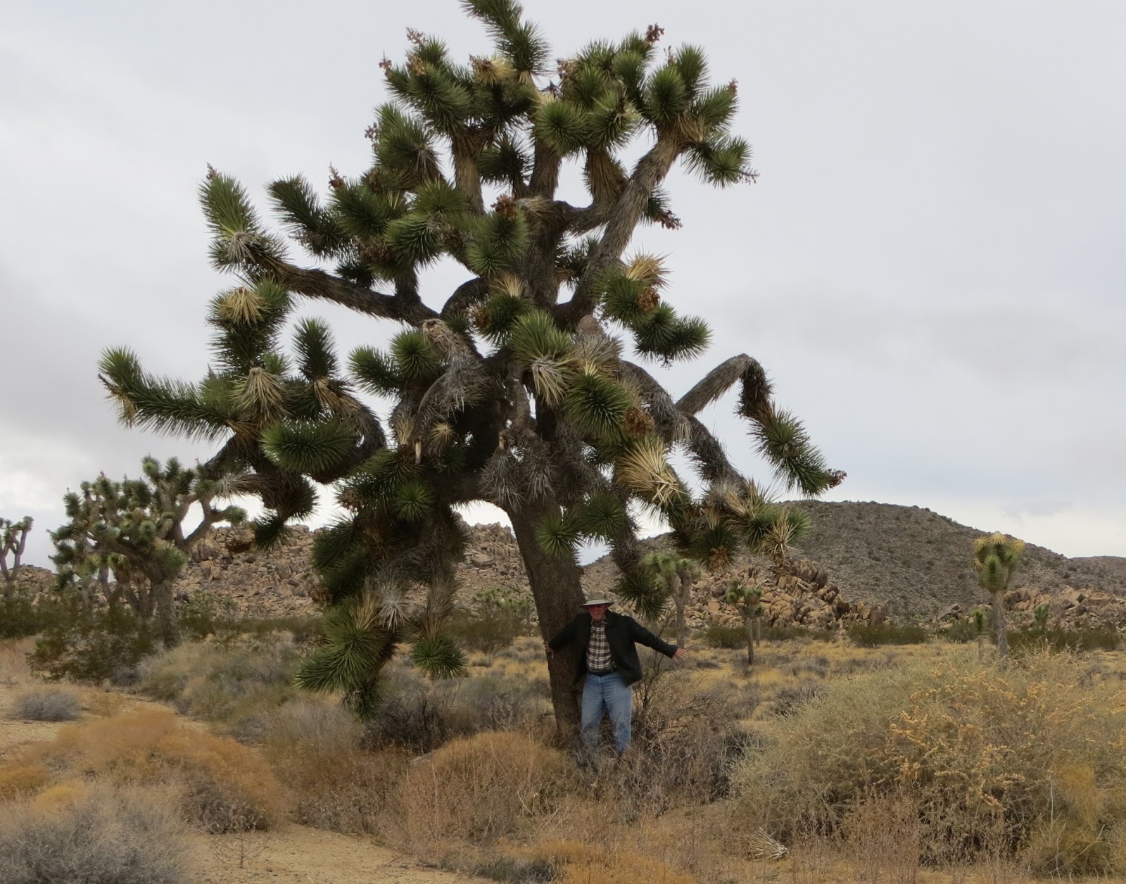
In Joshua Tree National Park, you can easily observe the intersection of the Mojave and Sonoran Deserts. The Mojave is high elevation and the Sonoran is low elevation, each with unique flora, fauna, and geology. The Joshua trees (Yucca variety) are found only in the Mojave, growing approximately 1-inch per year to a maximum height of roughly 40-feet. This is a park that is well worth the effort to visit!

Today, we shopped and did chores. The weather has warmed and I wore short and tee-shirt today. Great Christmas weather in Southern California!

12-30-15
We visited Sister Rose in LA and enjoyed a delightful time. Visiting at her hotel at the Woodland Hills Warner Center, in the San Fernando Valley, we caught-up on news and events from Mississippi and made plans to meet-up around her LA Tour schedule.
On Wednesday, Terry and I drove to Santa Monica, Venice Beach, Marina Del Rey, and then up to Pasadena.
The ocean views and landscaping along Santa Monica cliffs and the beach were splendid on a beautiful, sunny day, and the Santa Monica Pier was alive with a carnival atmosphere. We enjoyed walking the Park pathway along the ocean-front.
The Venice Beach Boardwalk was an eclectic mix of all the lifestyles (colorful characters) in LA. With no rules and sunshine all day, Venice Beach is nothing but fun!
Marina Del Rey was so impressive with the luxurious yachts and the restaurants, shops and marinas along the basin. This waterfront resort promises fun in the sun with tranquility. We walked some of the Quays, admiring the beautiful boats, and enjoying the morning sun shining through the trees.
Driving up to Pasadena on the 110, we were attracted to the Arroyo Seco Park and decided to spend some time in the park, following our visit to Pasadena.
The Rose Bowl festivities attracted very large crowds and seeing the process in-the-works was very interesting. We had dinner with Rose at a Ventura Blvd restaurant which was just right for a pleasurable dinner and visit.
On Thursday, we drove around the Beverly Hills neighborhood and cruised Rodeo Drive. Taking Sunset Blvd. over to Hollywood, we saw the Grauman’s TCL Chinese Theater with the walk-of-stars. European-influenced art mingles with classic film memorabilia and gaudy glitz. I was reminded of Woody Allen’s statement; “In Hollywood, they don’t throw out their trash, they make television programs from it”. On New Year’s Eve, it was packed with tourists from around the world.
We enjoyed some of the numerous, very nice parks around LA and met and talked to lots of friendly, engaging LA locals. It was a terrific visit in LA and we wanted to stay longer! 

Monday, November 30, 2015

Touring around our winter headquarters at Coachella Valley

Thursday, November 19, 2015

The view from our window where we live for the winter.

Some of the birds here for the winter, white pelicans, cormorants, Greebs, lots more.

We have learned that the entire Coachella Valley was once an inland sea, a northwest arm of the Gulf of California. Later, fed by the Colorado River, it was repeatedly flooded, creating a huge inland, fresh-water, lake. Shells from saltwater and fresh-water creatures are easily found around the valley and the ancient shoreline watermarks (bathtub rings) can be readily seen on the mountainsides. (Fact is stranger than fiction and Mother Nature makes strange facts!)
Today, we see the valley as a Colorado-Desert garden-spot, thanks to the irrigation from wells and the Colorado River. In the early days of California State, the place was   the dreaded Salton Sink, nemesis of many an early overland traveler. The valley slopes down to the Mexican border, creating the largest below-sea-level area in our country. Thanks to irrigation, the early developers renamed the Salton Sink to the Coachella Valley and the Imperial Valley, attracting settlers from all quarters. Today, we are amazed that this Salton Sink has become the playground of the “rich and famous” AND one of the most productive agricultural valleys in southern California.
From our site, we can see the valley from Indian Wells, Desert Hot Springs, La Quinta, Indio, Coachella, Thermal, and down to the Salton Sea. At night, the unexpected sea of lights, viewed from our site, is awesome. Curiously, regardless of the valley of lights, we can still enjoy some exceptional star-gazing in the cool, clear night air.

We wish all of our beloved family and friends a very blessed and enjoyable Thanksgiving 2015! As we spend our winter at gorgeous La Quinta, California, we persistently have affectionate thoughts of our cherished family and friends, in our hearts and minds, so please keep US in your hearts and minds too? We are fortunate to have your love and support in our “retirement adventures” and we are enjoying every minute of it. Of course, we absolutely delight in having visitors, so don’t miss a chance to visit us at Riverside County- Lake Cahuilla Regional Park, at La Quinta, in the great Coachella Valley.
Hugs to all!
Bob and Terry

Things to do list:
Empire Polo Club Polo Sunday 1-3/4-3 noon and 2pm $10
El Dorado Polo Club Sundays 1-10/4-3 $10

We never cease learning, with our latest geography lesson being that; the Coachella and Imperial Valley both lie in the Colorado Desert, a sub-division of the Sonoran Desert. We have travelled all over the Mohave Desert but never realized that its southern boundary is just north of the Coachella Valley and includes the Joshua Tree National Park. There’s a striking difference between the Mohave and Sonoran Deserts, concerning geography, flora, fauna, climate, minerals, and accessibility.
In the Spring of 1942, the 162-thousand-square-mile Desert Training Center, just east of Indio, was opened, under the command of General Patton, for training US (Armored Tank) soldiers to serve in North Africa. (I think that the DTC was situated, straddling both deserts.) It closed in 1944, having successfully completed its mission. Americans from the entire country trained here. (Do you know of anyone who trained here?) Another interesting fact is that; Calcite crystals, for the WW II, Norden bombsite, were mined at Anza Borrego Desert, another section of the Sonoran.


Friday, November 27, 2015
We took an overnight trip down the valley to the Salton Sea and the Imperial Valley. We passed by the Salton Sea on the west side (CA 86) and drove on down to El Centro, just north of the Mexico border. There’s an obvious presence of the US Border Patrol in this area. The Border Patrol uses the pistol range at Lake Cahuilla and they practice shooting more that the Sheriff’s Department So far, we haven’t heard of the US Border Patrol being involved in any questionable shootings.
This leg of our trip was a busy route with numerous winter “snowbird” residents around the lake towns, and loads of off-road vehicle riders, scrambling about the sand dunes and washes around the lake. We were surprised to see women and seniors riding the ATVs around the area. The riders roar about the dunes and washes and also ride into the towns to grab a burger and refreshments. Quite a site and a huge activity for visitors here. The scenery and sunset were nice and we were glad to get dinner and a comfortable motel, on a cool night in El Centro. Just like the Coachella Valley, Salton Sea and Imperial Valley are contained (surrounded) by mountains that abruptly rise around the valley floor. This makes for a late sunrise and early sunset.

View from shore at Salton Sea.  Lots of white and brown pelicans and many more birds.


Instead of sand the shore is all shells mainly barnacles!  No sand!
Today, we drove up the Imperial Valley and Imperial County, then along the east side of Salton Sea (CA 111). This, my first visit to the Imperial Valley brought back memories of my Uncle Joe’s 1950’s description of the valley, a desert-garden watered by the Colorado River. Also, I remember those colorful produce labels that came on some Imperial Valley products and how, as a child, those pictures told me a story about the wonderful farm-life in the Imperial Valley. Lovely scenery, happy ethnic people and neat rows of green produce extending to the purple mountains. Now, I know that the Imperial Valley is a lot like the Mississippi Delta and other large agricultural areas. Mainly, weathered farms with every piece of equipment, ever owned, (old and new/junk and state-of-the-art) sitting out around the farmsteads, on multi-million dollar farms.

Other curious observations in the Imperial Valley were;
-Referencing the California Dept of Ag before traveling to Imperial Valley, we discovered that cattle are the number one revenue in the valley. With thousands of acres in produce this seemed strange. Strangely, Beef cattle IS the number one crop in the valley. You see a lot of alfalfa and grass hay(corn comes by rail) produced but the cattle are inconspicuously concentrated into feed lots. We saw Superior Cattle Feeders at Calipatria, with a lot capacity of 80,000 head, specializing in cheap Holstein steers (dairy farm rejects) under 20-months old. They feed them out and slaughter them down the road at their Brawley plant, producing high revenue (lower quality) beef products. They export lots of beef to Japan so I guess the Japanese can take tough, not-prime beef and make it tasty.
-In conjunction with the huge feed lots, Citrate Manure Power Plant processes and burns feed-lot cow manure, making electricity. They also sell the ash byproduct to asphalt manufacturers and geothermal well drillers. We were surprised that cattle was number one in Imperial Valley but thanks to a low-visibility, integrated operation, we now see why.
-Speaking of electricity, there are numerous geothermal facilities, producing electricity in the Imperial Valley, along the San Andreas Fault. Using deep injection and production wells, they feed steam-turbine generation facilities. Ironically, ash from the Cow Manure Power Plants is used to corral toxic waste-spills from the geothermal production wells.
-We also observed a mountain of unrefined sugar, waiting to be refined at the Speckles beet Sugar plant in Brawley. Sugar beets are grown and processed in the valley into refined sugar. They plant in Sept. harvest in April and produce 40/tons beets per acre, yielding 14,000 pounds of sugar. Lots of the byproducts go to cattle feed for those huge feedlots.
- Produce crops rank next behind cattle.
It is fun making all the connections between these technological and high-tech operations. It always comes down to maximizing revenue by marketing every possible material, prime or byproduct, and sometimes creating markets through cooperation with your neighbors.
We did enjoy seeing the Imperial Valley and appreciate all the wonderful contributions that they make to the dinner table. Regardless of the roughness, smell, and dust of the ag operations, we are glad that we visited the Imperial Valley.

Along the eastern shore of Salton Sea we thoroughly enjoyed the birds, shoreline, mountain views, and a picnic under the shade of a beach ramada. The beach sand was composed of Barnacle shells. We were surprised to learn that barnacles thrive in the Salton Sea and account for the shoreline material that resembles very coarse sand. Later, we strolled through their Native Plant Garden and identified the local desert plants. We also saw some fine specimens of California’s native Fan Palm. When left untrimmed, the Fan Palms, become large, shady habitat for all sorts of birds and animals.
The unparalleled 360-degree views of the Santa Rosa, Oracopia, and Chocolate Mountains make every morning sunrise and evening sunset an amazing event. Salton Sea, 332 feet below sea level, is a dead-sea, with increasing salt content but its name comes from the Salton Sink. Hopefully, with its critical importance to migratory birds on the Pacific flyway, the Salton Sea can be saved. We’re glad we visited Salton Sea AND the Imperial Valley.